Know the ground before you break it.
Drone LiDAR and 3D site models for builders, engineers, and landowners around Kansas City, usually delivered within the week.
Get a site quote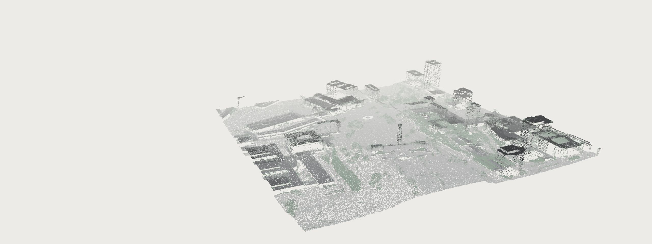
- Elev
- ---.-
- Above grade
- --.-
- Lat
- --.-----
- Lon
- ---.-----
Loading the scan
Union Station and the Liberty Memorial, modeled from public USGS LiDAR (2020).
What the drone brings back.
Every surface the laser touched: roofs, treetops, lawn, the top of the tower. This block is 3.2 million points, each with a real elevation. The view draws a sample of them.
Bare earth.
Take away the buildings and trees and the terrain underneath shows up: the Liberty Memorial hill and the slope down to Pershing Road. The blank shapes are building footprints: no laser reaches the ground under a roof. Grading and drainage plans start from this surface.
Contours, every five feet.
The same ground, drawn the way engineers read it. The heavier pink lines fall every 25 feet. On a real job your civil engineer gets these as CAD linework.
Structures and canopy, sorted.
Buildings in dark ink, trees in gray-green, ground faded back. That sorting gives you footprints, roof heights, setbacks, and how much of a lot sits under tree cover.
Measure anything.
Pick a point on the model, then a second one: distance, rise, and slope. The Liberty Memorial tower is published at 217 feet. See what the scan says.
What you get back.
- Site model
- The full point cloud and a surface model, tied to real coordinates. Opens in your CAD, your GIS, or a browser.
- 3–5 business days
- Topography & contours
- A bare-earth surface with contours at whatever interval your engineer asks for.
- 3–5 business days
- Volumes
- Stockpiles and cut-and-fill quantities, measured from the scan so you can bill against them.
- Next business day
- Progress scans
- The same site flown on a schedule, so each visit can be compared with the last.
- Weekly or monthly
- Drainage mapping
- Flow paths, low spots, and where water will pond, for grading and field drainage.
- 3–5 business days
One flight, three steps.
- 01
Fly
A licensed Part 107 pilot flies the site, usually in under an hour for 100 acres, with airspace approval handled, including near the downtown airport.
- 02
Process
Raw returns get cleaned, sorted, and tied to survey control, so every point carries a real elevation.
- 03
Deliver
Files for your CAD and GIS, plus a browser link like this one that anyone on the project can open and measure.
Tell us about the site.
Send an address and a rough boundary. We'll come back with a flight plan and a fixed quote within a day.
Get a site quote